
by Don Hagen
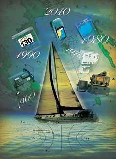
Progress in marine electronics communications and navigation systems has been amazing over the past six decades. In the 1950s, the only electronic aids for recreational boaters were radiotelephones, depth sounders, radio direction finders, and a few primitive autopilots. Lets take a look at how far we have come.
Marine communication systems
Early marine radiotelephones used a few medium-frequency double-sideband AM channels with technology similar to AM broadcast stations. Interference from other users was a problem, particularly when sky waves propagated at night.
By 1977, this service had given way to high-frequency single-sideband AM for transoceanic communication and very high frequency FM for local use. VHFs line-of-sight propagation limits greatly reduced interference. Frequency modulation, or FM, reduced radio background noise, and its capture effect suppressed interference from weaker signals. Frequency synthesizers have supplanted individual channel crystals so marine radios can now accommodate all channels within their operating band.
Since 1999, all fixed marine radios sold in the U.S. must have at least minimal digital selective calling capability. DSC radio users can send a distress message to coast stations and other nearby DSC-equipped vessels by merely pressing a red button. If interfaced with a GPS or LORAN receiver, the DSC radio also provides the vessels location.
Although voice communication on traditional channels continues, boaters with DSC radios can now initiate non-emergency contact using a unique Maritime Mobile Service Identity number, analogous to a telephone number. After digital acknowledgement, both radios automatically switch to a specified channel, eliminating the need to make initial contact on the busy calling and distress channel.
Satellite communications started with the Soviet Unions experimental Sputnik satellite program in 1957 followed by a series of experimental U.S. communication satellites. These led to the passage of the Communications Satellite Act of 1962 and the formation of the civilian Communications Satellite Corp., or Comsat.
Today satellite communications companies enable us to phone anyone nearly anywhere, call for help, watch TV in the middle of the ocean, obtain weather forecasts, send and receive e-mail, and more.
Then in the 1960s, the Department of Defense Advanced Research Projects Agency developed ARPANET, a data communications network that allowed government researchers to time-share large scientific computers. In the 1980s, ARPANET became the civilian Internet, which now carries the World Wide Web, e-mail and other software services. Many boaters now have onboard Internet connections via Wi-Fi, cell or satellite phone, or HF-SSB radio.
In 2007, the U.S. Coast Guard terminated the long-standing 121.5 megahertz emergency position indicating radio beacon system, and boaters desiring an emergency rescue beacon must now carry a 406 MHz EPIRB or personal locator beacon. Both provide position coordinates when enhanced with GPS capability.
Operational since 1984, Cospas-Sarsat, the satellite-based 406 MHz EPIRB search and rescue system, provides global coverage using both polar-orbiting and geostationary satellites. Mayday signals sent by EPIRBs and PLBs are received by these satellites, processed by a Cospas-Sarsat ground station, and forwarded to a rescue station for subsequent action. If the signal contains a GPS position, the satellites can relay the position information, accurate to about 300 feet, to a ground station in as little as three to five minutes.
Electronic navigation systems
In the 1950s, dead reckoning and visual piloting were the tools of the trade for coastal passages, and celestial navigation was preferred for ocean voyages. Some boats had radio direction finders, and many had ultrasonic depth sounders with flashing-light depth indicators.
Then along came LORAN, a long-range navigation system that transmits pulsed low-frequency radio signals from shore-based transmitters.
Originating during World War II, LORAN was designated the government-sponsored navigation system for the U.S. Coastal Confluence Zone in 1974. Within that zone, the absolute accuracy of the current version, LORAN-C, is one-tenth to one-quarter of a nautical mile, and the repeatable accuracy is 50 feet.
Although scheduled to be shut down in 2000, LORAN-C continues to receive Congressional funding for upgrades and development. As a result, todays enhanced or eLORAN uses signals from every LORAN transmitter within operating range.
The first marine electronics networking application involved connecting a LORAN receiver and an autopilot to automatically steer a boat to a waypoint. In 1980, the National Marine Electronics Association developed the NMEA 0180 standard for data sharing between two devices. For the next two decades, NMEA 0183 became the standard, and someday, new boats might be equipped with a factory-installed NMEA 2000 bus to standardize instrument connections and carry data for a multifunction display.
Navigation satellite programs began shortly after the Sputnik launches, with the first operational system, TRANSIT (also known as NAVSAT), being launched in 1959. TRANSIT used the observed Doppler frequency shift pattern from a satellite signal to establish the receivers position. The TRANSIT system was phased out in 1996.
The NAVSTAR Global Positioning System, a satellite-based radio navigation system, became operational in the early 1990s. Although the Defense Department operates GPS as a military navigation system, its widely used by both commercial and recreational boaters and has become the navigation system of choice for ocean voyages.
GPS uses a constellation of evenly spaced satellites in 12-hour inclined Earth orbits. With satellites continuously in view, GPS is more accurate than the NAVSAT system and doesnt have the geographical limitations of ground-based LORAN-C transmitters.
To prevent potential enemies from acquiring such accurate positioning capability, the Defense Department installed a Selective Availability option that reduced accuracy for civilian users to 100 meters, or about 328 feet. SA was turned off in 2000, resulting in an accuracy of less than 10 meters.
To overcome this intentional degradation for U.S. civilian users, the USCG implemented Differential GPS in the 1990s. This augmentation system provides an accuracy of 10 meters, or about 33 feet, regardless of SA degradation and varying propagation delays. A GPS reference receiver installed at a surveyed location measures the ranges from all satellites in view, compares them with what the range measurements should be at its known location, and transmits the differences to DGPS receivers over a separate radio link. This correction signal is useful within 100 miles of the reference site.
Developed by the Federal Aviation Administration and operational since 2003, the U.S. Wide Area Augmentation System uses ground stations to enhance GPS accuracy. Each ground station compares its GPS position with its known location to correct range errors for each GPS satellite. These corrections are then broadcast from a master station through satellites on the same carrier frequency as GPS. Currently WAAS has 25 ground stations in the U.S. and usually provides three-meter positional accuracy. WAAS will likely supplant DGPS because it is more accurate and does not require a separate radio to receive corrections. The Europeans and the Japanese are now developing their own WAAS-compatible augmentation systems.
The principles of radar have been known since 1915, but World War II forced its practical development. Since then, technological advancements have substantially reduced radar size, weight and power requirements.
Improvements in detection sensitivity, accuracy and automated controls have made modern radar feasible for small recreational craft.
Small boat radars consist of a display and scanner. The scanner, containing the antenna and the transceiver, usually comes in an 18- or 24-inch size, with the smaller scanner working well for general collision avoidance and coastline monitoring. Modern digital signal processing provides one-degree bearing accuracy.
Microprocessor advancements have made Automatic Radar Plotting Aids feasible. ARPAs can automatically track 10 or 20 targets continuously, providing information on their range and bearing, course and speed, and closest point of approach.
Developed in 1984, the raster-scan display enables radar images to remain on the screen between successive radar sweeps instead of fading. Additional improvements, including daylight-viewable color displays, LCD flat screens and multifunction display technology, have been introduced since the late 1990s.
The Automatic Identification System, a shipboard radio system with a radar display, has been required on most oceangoing commercial vessels since 2003 and may become useful for some recreational boaters.
In the past decade, chart plotters have become increasingly popular on recreational vessels. Ranging from small handheld units to full-color, large-screen displays, chart plotters consist of a GPS antenna and receiver with a display that indicates the vessels position on an electronic chart. You can use waypoints on the chart, pan, and zoom in and out. Chart plotters can drive an autopilot and interface with a laptop computer, enabling cruisers to plan their trips at home and on board.
Produced by several companies, some electronic charts can be used with specific chart plotters while others require a separate laptop computer.
Newer features include perspective views, aerial photo overlays, arrows showing current set and drift, and blinking symbols for flashing-light buoys.
Electronic charts come in two types: raster and vector. Raster charts are scans of actual National Oceanic and Atmospheric Administration paper charts and require additional PC navigation software. Vector charts are drawn from NOAA master copies, stored on small memory cards and used with GPS chart plotters. Navigation software is included in the chart package. Vector charts still dont look exactly like paper charts, but they are improving.
Electronic chart overlay, in which a radar picture overlays a chart plotter display, makes the radar display easier to interpret, especially for inexperienced operators.
In the 1950s, many boaters still sounded with lead lines although flashing-light depth sounders were available. Those early depth sounders have spawned a range of products, distinguished primarily by their display.
The simplest is the digital depth indicator, which bounces an acoustic signal off the sea bottom, determines the depth and displays the result in a digital readout.
On the other hand, a fish-finder displays the bottom depth and density and identifies the depth of targets on a graphical display. Since 2003, integrated digital signal processing has improved the clarity and resolution of fish-finders.
Scanning sonar displays the water depth ahead of the boat. It forms an acoustic beam in a 90-degree vertical arc from just below the surface of the water to the bottom, revealing shallow water, obstructions and submerged obstacles. Some scanning sonars can see as much as 1,200 feet ahead or up to six times the waters depth. Side-looking sonar is also available.
In the fascinating world of marine electronics, what do you think the next 60 years will bring?
P/R/C Don Hagen, SN, is a past chairman of the Marine Electronics Committee. A registered professional engineer with a Ph.D. in electrical engineering, he worked in the defense electronics industry for 40 years. Now retired, he holds a USCG 100-ton Masters License and has cruised with his wife, Ruth, on their sloop for more than 30 years in New England waters.
|